Sea temperatures
Current sea temperatures at Adriatic stations.
Sea temperature Croatia
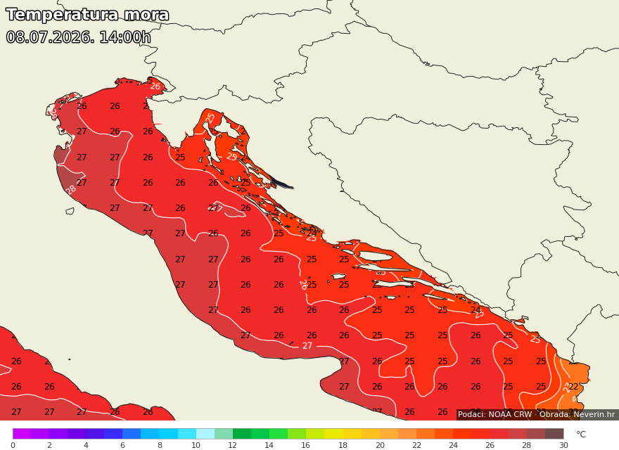
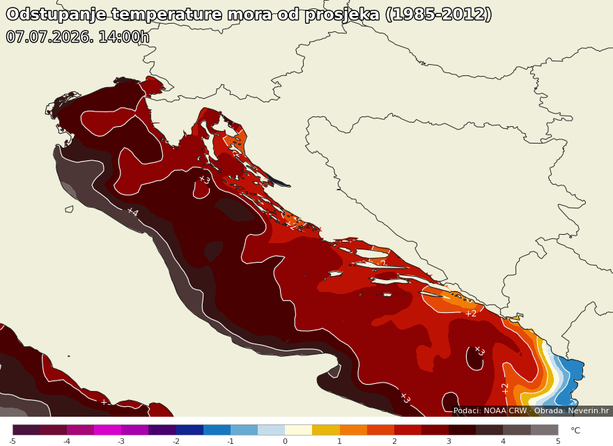
Sea temperature Europe
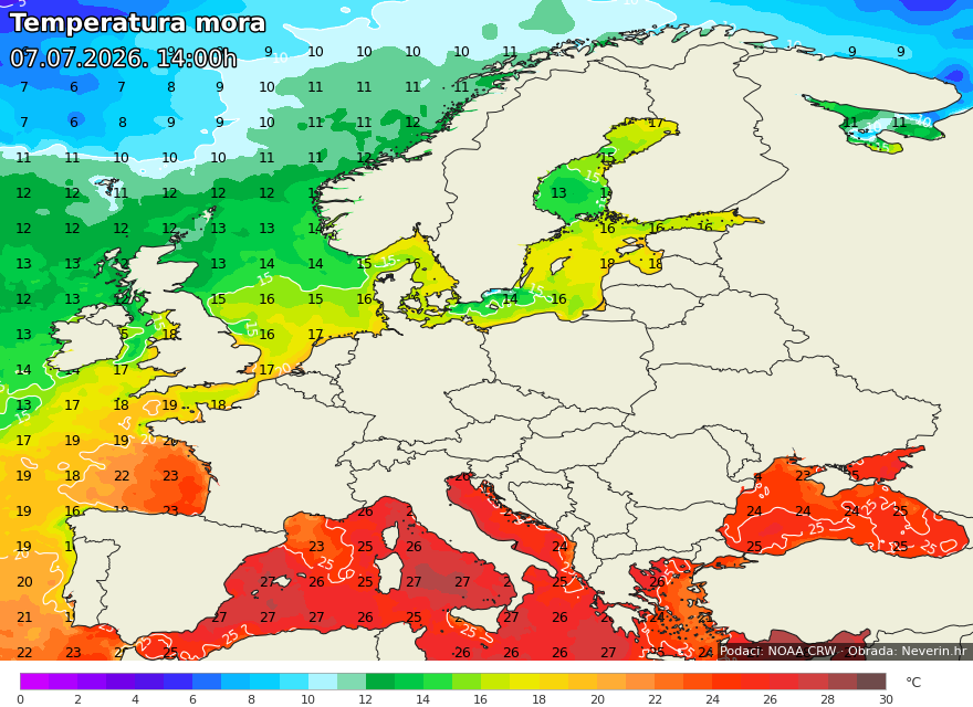

Frequently asked questions
How is sea temperature measured?
At weather stations, sea temperature is measured about 30 cm below the surface, at an open spot at least 1.8 m deep. It is measured by automatic weather stations or with a thermometer read by an observer.
Why does the temperature on the map differ from the one at a station?
The map shows a satellite measurement of the sea's surface layer in the open sea, while stations measure right by the coast, where temperature is affected by shallows, currents and freshwater inflow. Small differences are therefore normal.
What does "sea temperature anomaly" mean?
It is the difference between the current temperature and the long-term average for that time of year. A positive anomaly means the sea is warmer than usual, a negative one that it is colder.
Which temperatures are considered pleasant for swimming?
For most people, sea above 24 °C is considered pleasant for swimming. Between 20 and 24 °C the water is cool but acceptable for most, while below 20 °C a stay in the sea becomes short and bracing for most people.
Where does the data come from?
The satellite sea-temperature maps are based on data from NOAA Coral Reef Watch and are updated once a day, around 4 p.m., for the previous day. The per-station values come from measuring stations along the coast, mostly from the Croatian Meteorological and Hydrological Service (DHMZ), and are generally updated several times a day.
The data shown is for informational purposes. The actual sea temperature at a specific location may differ due to currents, wind, depth and local conditions.